The Briancon Alps (Hautes-Alpes) are considered the high
mountains southeast of Grenoble and south of the 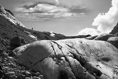 Massif de la Vanoise. To the south you have
the Alps de Provence and to the east the Italian border
(Montgenevre in Italy is only 30 minutes drive east of
Briancon.) The region is sliced in two by the Durance
river with the Parc National des Ecrins on the western
side and the Parc Naturel Regional du Queyras on the
eastern side.
Massif de la Vanoise. To the south you have
the Alps de Provence and to the east the Italian border
(Montgenevre in Italy is only 30 minutes drive east of
Briancon.) The region is sliced in two by the Durance
river with the Parc National des Ecrins on the western
side and the Parc Naturel Regional du Queyras on the
eastern side.
The old fortified town of Briancon is one of the highest towns in Europe (1321 m above sea level). With an imposing citadel, sitting on a rocky outcrop high above the Durance valley, Briancon was originally fortified by the Romans to guard the road from Milan to Vienne. The town now forms part of the winter sports complex of Serre-Chevalier and offers good facilities to tourists.
We have used Briancon as our base for summer hiking in the Alps since 2007 and we find exciting new areas each year. The walking guide “Guides Franck” no. 18 of the “Brianconnais” was a very good starting point together with local IGN hiking maps.
As a photographic project, the Briancon Alps is still in its early stages for me. I expect to continue going there for many more years to come before beeing able to present the final version.